
CONSERVATION TECHNOLOGY
OUR SOLUTIONS:


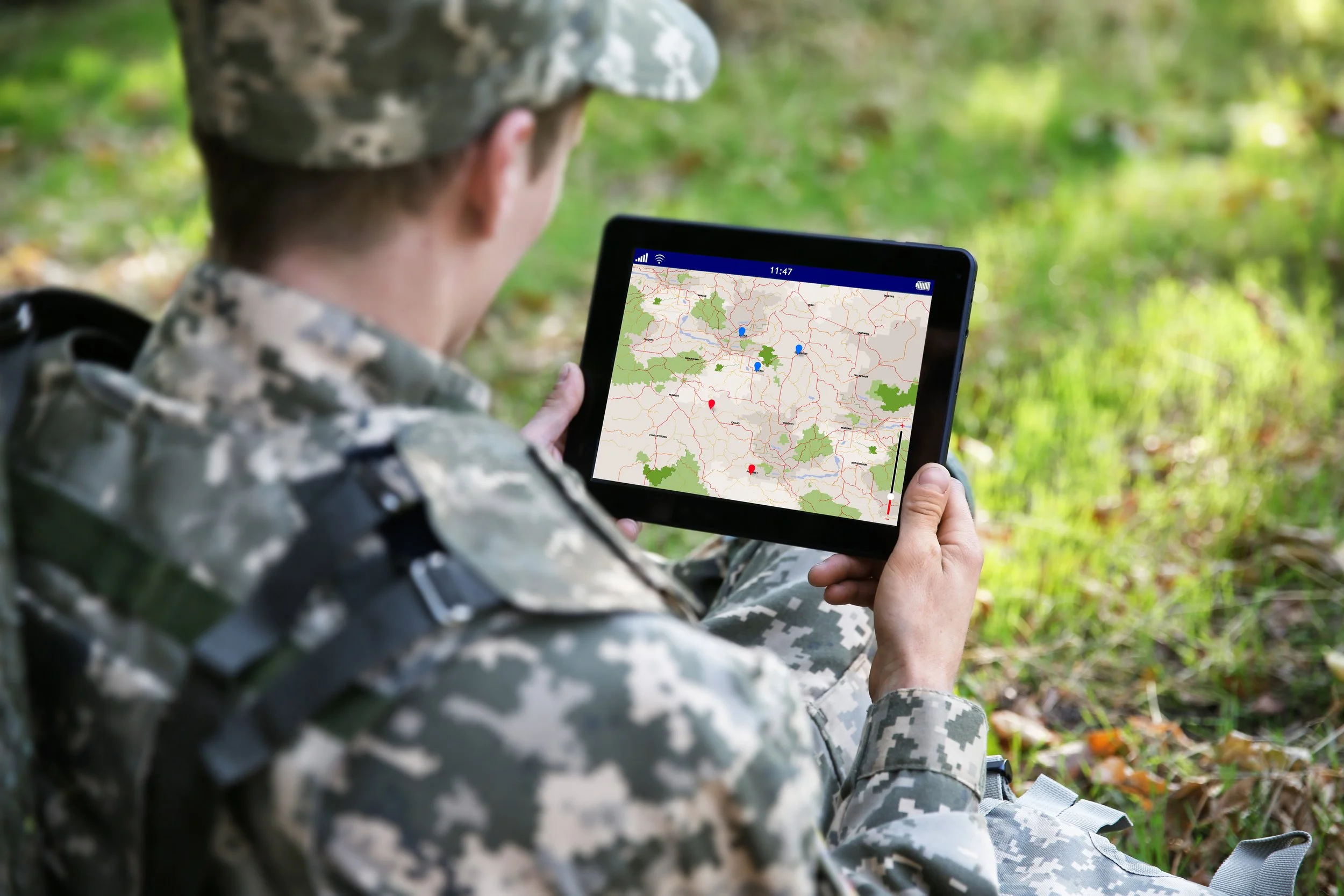
REMOTE MONITORING + AI-ENHANCED SURVEILLANCE

Information is critical to adaptively monitoring a landscape, and our team puts its vast knowledge of technology in service to enhance the flow of data to protected area managers.
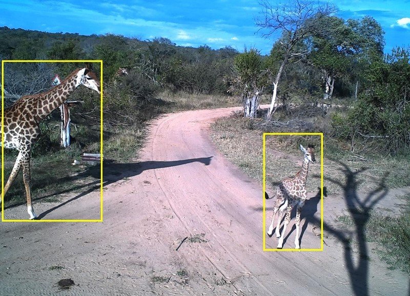
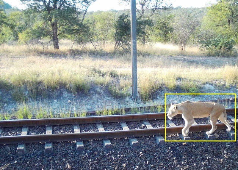
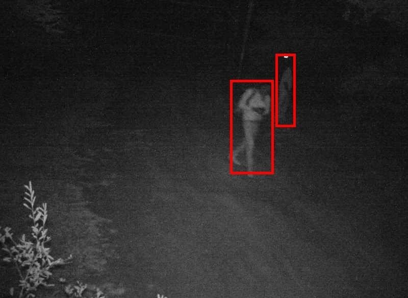
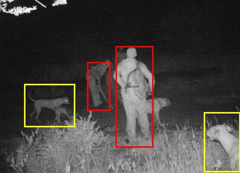
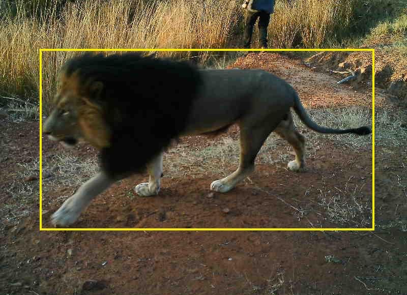
WpsWatch, our flagship conservation solution, enables wildlife reserves, provincial parks, and other protected areas to actively monitor and respond to real-time alerts from an array of sensors such as camera traps, thermal cameras, IPTV, and more.
This free tool is available on any mobile, tablet, or desktop browser, and leverages the latest innovations in artificial intelligence to provide usable information to you and your teams.
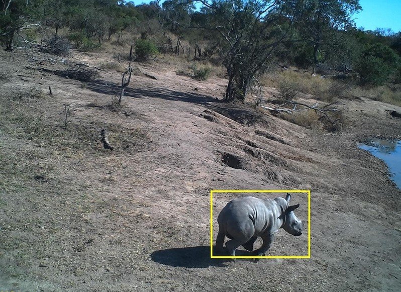
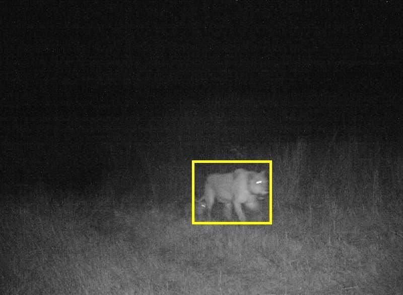
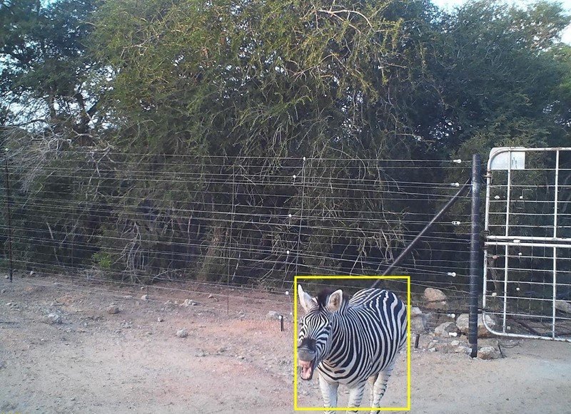
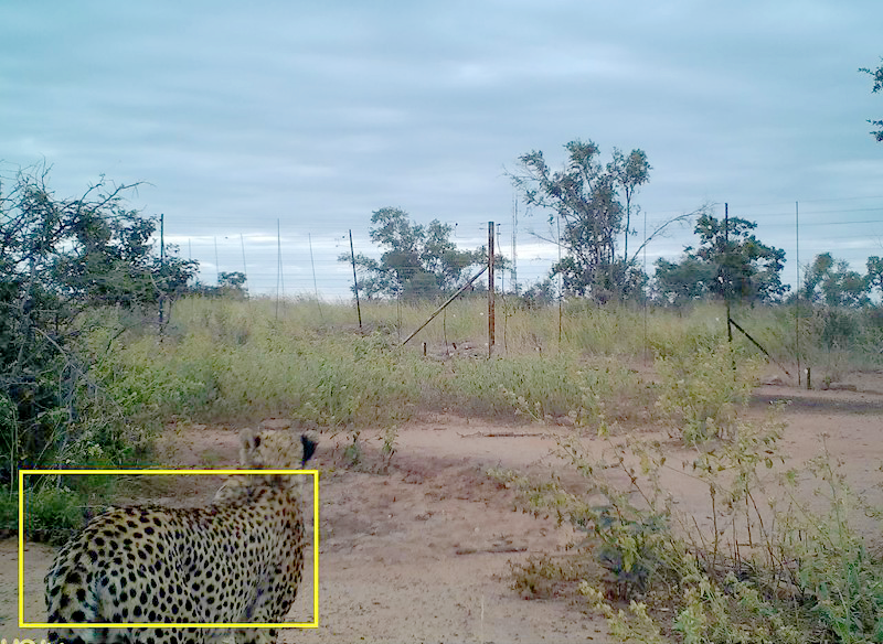
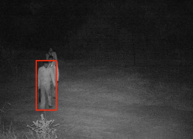
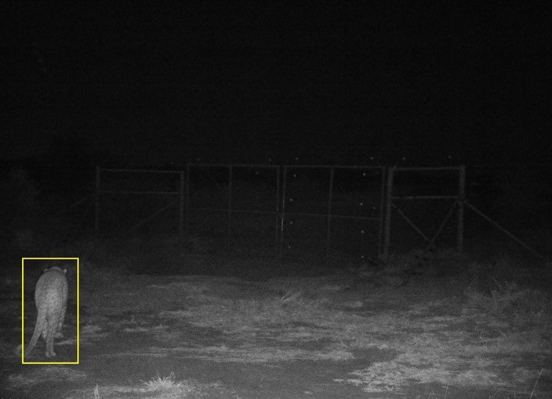
CAPTURED IMAGES FROM WPSWATCH:


REPORTING TOOLS + PROTECTED AREA MANAGEMENT

In today's world, protected area managers face an ever-increasing number of challenges. Data-driven management based on timely and accurate information can be the difference between long-term success or failure of a protected area.
In collaboration with the SMART Partnership and EarthRanger, we provide the training, tools, and support to help our field partners adaptively manage protected areas and enhance conservation outcomes. From data collection, analysis, monitoring, and reporting, our team is here to help those charged with landscape-scale ecological protection and optimize conservation efforts.


CONFLICT MITIGATION SYSTEMS FOR HUMANS + WILDLIFE

As human pressures on the natural world increase over time, conflict between wildlife and human interests seems inevitable.
Our team has developed and deploys conflict-mitigation technology that works to reduce such scenarios through the provision of remote monitoring, early alerting, and proactive, automated deterrence of wildlife or humans in sensitive areas.

DATA ANALYSIS + INTEGRATION TOOLS

GUNDI
WPS is a founding partner of the Project Gundi collaboration.
Gundi (meaning ‘Glue’ in Swahili) is designed to enable universal integration between field sensors and data repositories, simplifying the process of technology adoption for field practitioners and enabling streamlined data access for all of conservation.

AKILI
WPS is also a founding member of Akili.
Akili is an open-source, end-to-end, practitioner-focused platform for collecting, managing, and analyzing camera trap and other sensor data for conservation management, scientific research and more.
